Wicklow Way
East Ireland | County Wicklow
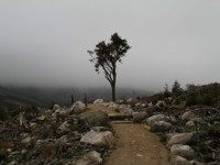
The Wicklow Way it's Ireland's first and longest officially marked hiking trail (132km). It's not always easy to follow it, even if it is marked, but maybe that's one of its charms. It takes approximately 6-7 days to pass the entire path. It starts from Marlay Park in Dublin. Trail quickly leaves the Dublin behind as it climbs into the mountains and sheltered glens of County Wicklow. Wicklow Way runs along a ridge above Powerscourt Waterfall, passing round the the heather-clad shoulder of Djouce to reach its highest point(White Hill, 630m). Soon afterwards, it passes a memorial to J B Malone, architect of the Wicklow Way. Appropriately, this overlooks Logh Tay, which he described as “the jewel of these hills”. Then passes the well-preserved Glendalough Monastery. After waterfalls and oak woodlands of the Wicklow Mountains National Park, it climbs the shoulder of Mullacor Mountain and descends into the valley of Glenmalure. From Tinahely, trail meanders round lush farmlands before finishing at small village of Clonegal, County Carlow. If you plan to go the whole trail, you can take the bus 16A from Dublin's city center (O'Connell Street) which will take you to the Marlay Park. The Way is 132 km, but remember, that most of the trail leads away from villages, so if you leave the path(for example to buy a food or for overnight stay), it will extends its length. Probably the most beautiful part of Wicklow Way runs between Enniskery and Glendalough, which reaches the highest point at White Hill (630m). This is approximately 3 days walk. Bus nr 44 from Hawkins Street in Dublin will take you to Enniskery where you can start walk. You can go back from Glendalough to Dublin using St Kevin's Bus Service. Apart from the winter time (most of B&B's is closed and public transport is less frequent), there is no bad time to walk the Wicklow Way. However, you should be prepared for cold, wet and windy weather at any time of year. Walking it will gives a grand sense of achivement.
Photos from Wicklow Way


